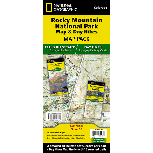
The Rocky Mountain National Park Trails Illustrated map is the most comprehensive recreational map for Rocky Mountain National Park. Coverage includes Rocky Mountain National Park, Arapaho and Roosevelt National Forest, the Never Summer Wilderness, Arapaho National Recreation Area, and the cities of Granby and Estes Park.
New features include: easy-to-read trail mileage and markers, easily distinguishable hiking-only and hike and horse trails, clearly marked Federal, State and Private lands, and a highlighted Continental Divide Trail. The map’s shaded relief makes it easy to see the lay-of-the-land, and it has a full UTM grid for use with a GPS.
The Rocky Mountain National Park Day Hikes Map includes 16 different day hikes along with information on trail length, difficulty, elevation change, and notable landmarks.
Approximately 4 1/4″ x 9 1/4″ folded; 25 1/2″ x 37 3/4″ fully opened. Scale = 1:50,000